Mobility, Security and Gender in Popular Neighborhoods – City of Buenos Aires
Secretariat of Transportation and Public Works GCBA, Housing Institute of the City and Development Bank of Latin America.
October 2021 - October 2022
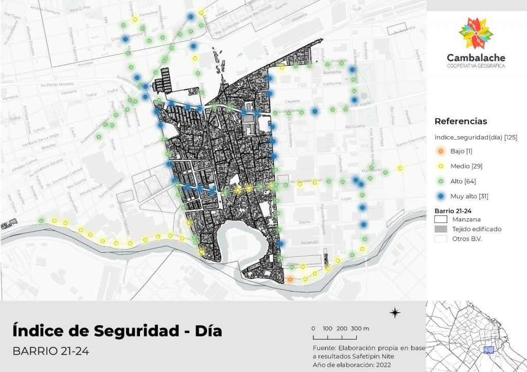
We participated in the Field Information Collection with the Safetipin Apps and with the qualitative methodology Participatory Mappings in Public Spaces. The work consisted of surveying and analyzing the infrastructure associated with public transportation, mobility and security of residents in 8 popular neighborhoods of the city of Buenos Aires: Barrio 1-11-14; Barrio 20; Barrio Ramón Carrillo; Barrio Zavaleta; Barrio 15; Barrio Fraga; Barrio Rodrigo Bueno and Barrio Lamadrid.
The project presented a quantitative and a qualitative survey instance. In the first, the territory was surveyed with the Safetipin applications, where data was collected from the neighborhood infrastructure associated with mobility and public transportation.
In the second stage, the Participatory Mapping methodology was developed to understand the perceptions of security, transportation and mobility of the residents in each of the 8 popular neighborhoods.
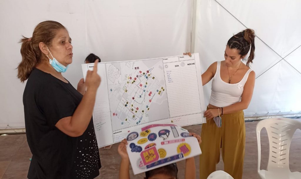
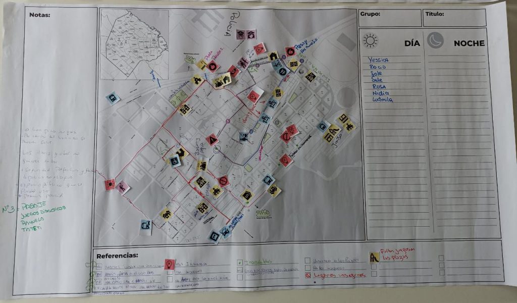
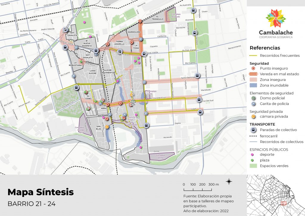
After the Mapping workshops, the analysis and identification of the mapped geographic objects and the maps designed by the residents took place. In this way, the “subjective” information becomes a contrastable layer with basic spatial information such as infrastructure, services, environmental surroundings, economic indicators, etc.
To learn about the results achieved and download them, go to the following news (link).
Find the results and more about the work in the following publications:
Download the publication “Ellas se mueven seguras (They move safely)”
The following technologies were used in this project: